🌍 Google has released AlphaEarth Foundations, a groundbreaking open dataset that encodes every 10-meter square of Earth from 2017 to 2024 as time-based embeddings — capturing how the planet changes across years and seasons.
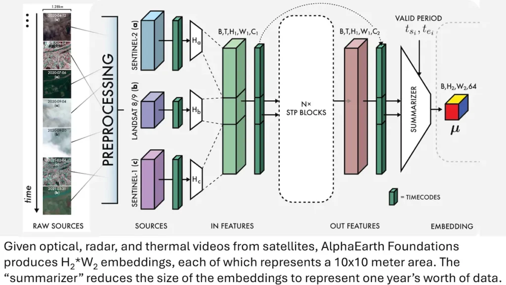
Trained on optical, radar, and thermal satellite data and aligned with geotagged text, these embeddings allow AI systems to track shifts in climate, land use, vegetation, water, and urban growth with unprecedented precision.
A New Foundation for Climate and Earth AI
AlphaEarth Foundations is designed to serve as a universal representation layer for Earth observation, making it easier for researchers to build models that monitor environmental change, predict crop yields, detect deforestation, or measure disaster recovery.
The dataset is free to download under a CC BY 4.0 license, and Google is also offering research grants to teams using the embeddings for scientific, environmental, and policy applications.